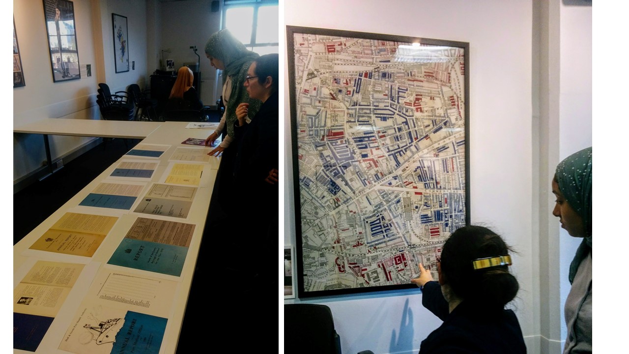
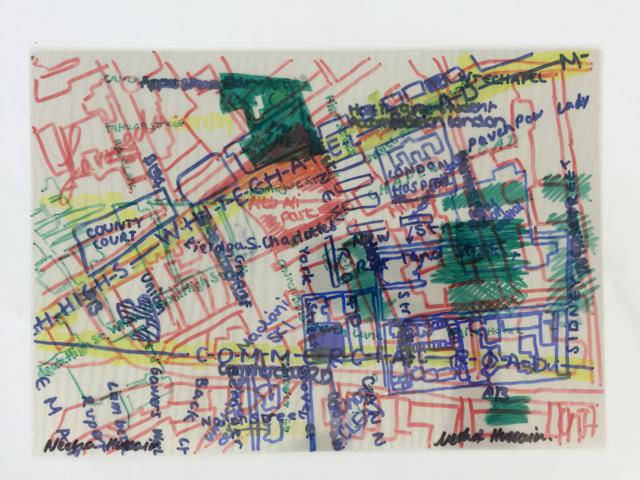
We're delighted to welcome two energetic researchers to our team to further the Survey's work in the community. Nishat Alum and Tanha Quadi are both Whitechapel born, and have themselves witnessed and been part of the changes that the area has seen. They will primarily be involved in oral histories and working with local groups to access those experiences of Whitechapel that can be more difficult to uncover.
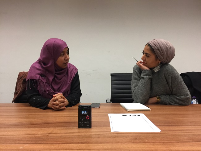
Nishat is passionate about local history and also works at Redbridge Archives, and can be seen here interviewing Mahera Ruby about growing up in Whitechapel.
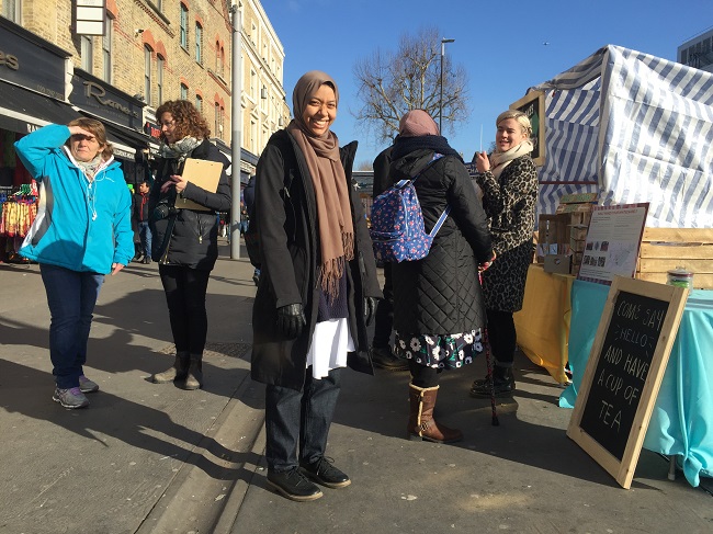
Tanha is actively involved in local community initiatives, and has recently worked with Toynbee Hall on their archives project. Here she is speaking to people on Whitechapel Road about their experiences of the market, in a consultation exercise alongside design firm Make Good.
Watch this space for more work from Nishat and Tanha.
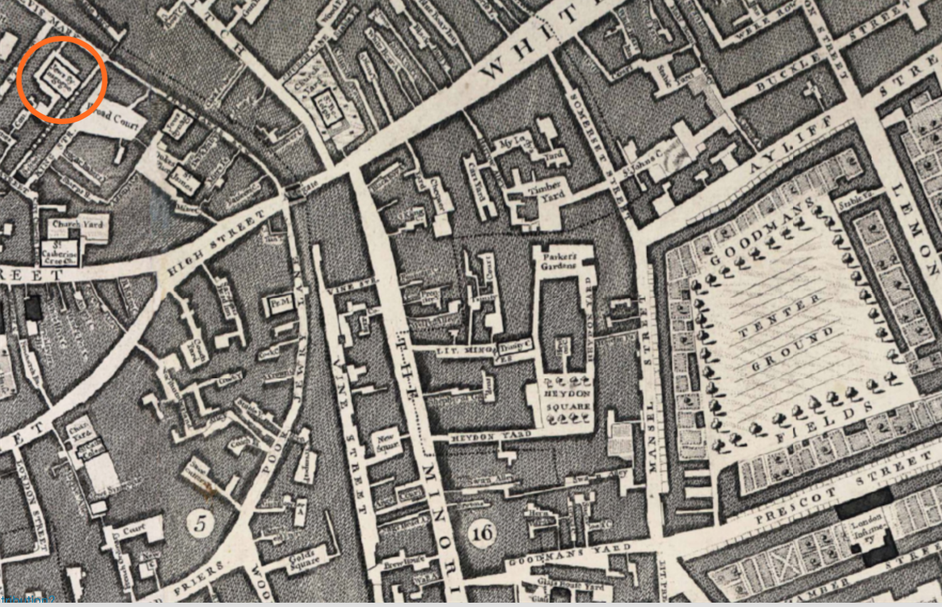
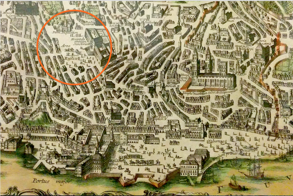
Bevis Marks Synagogue in the City of London has served London’s Sephardic Jewish community for more than three centuries. Members of the ‘Spanish and Portuguese Synagogue’, as it was known in the eighteenth century, tended to live to the east of the City in the parish of St Botolph’s Aldgate. Yet many Sephardic Jews of Spanish and Portuguese origin also took up residence in Whitechapel, still only a short walk away from the synagogue. The Survey’s research into the early development and inhabitation of Goodman’s Fields is beginning to uncover the strength of this community’s association with the area, enriching our understanding of the character of this once affluent pocket of Whitechapel.
Extract from John Rocque's 1746 map of London. Bevis Marks Synagogue is highlighted in orange. The Tenter Ground of Goodman's Fields to the east.
A recent excursion to Lisbon brought one of the Survey’s historians into contact with Carla Costa Vieira, a doctoral researcher based at Universidade Nove de Lisboa. Vieira is exploring archives in London and Lisbon in order to trace the Portuguese Jews, or ‘New Christians’, who escaped to England in the early decades of the eighteenth century to avoid persecution and punishment under Lisbon’s notorious Inquisition. The records of Bevis Marks have been an important reference point for Vieira in identifiying the men, women and children who travelled to London at this time. Her work is focused on the agents, networks and mercantile exchanges that enabled many Portuguese Jews to establish themselves as successful traders in London, and indeed Whitechapel, having migrated on one of the many ships leaving Lisbon’s busy colonial port. Assisted by the Methuen Treaty of Commerce of 1703, which granted English ships immunity from Portuguese laws, many escapees maintained close commercial links with Lisbon, entering into partnerships with English merchants in both cities to exploit the potential of trade with the West Indies and South America. However, many Sephardi refugees came to London with little and were at least initially reliant on Bevis Marks for charity, sometimes later establishing themselves as successful businessmen and notable community leaders.
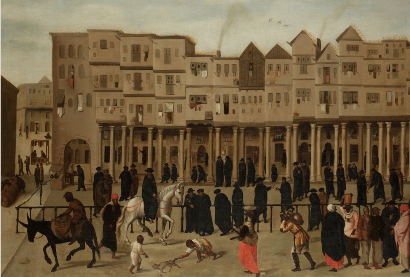
Sixteenth-century Rua Nova dos Mercadores, Lisbon. This street was the centre of mercantile activity in Lisbon before the 1755 earthquake, which destroyed much of the city. Image: Society of Antiquaries, Kelmscott Manor.
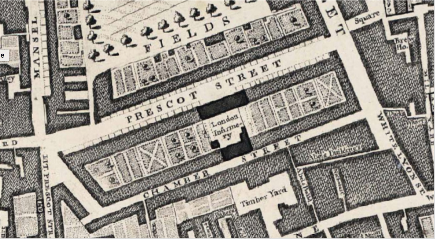
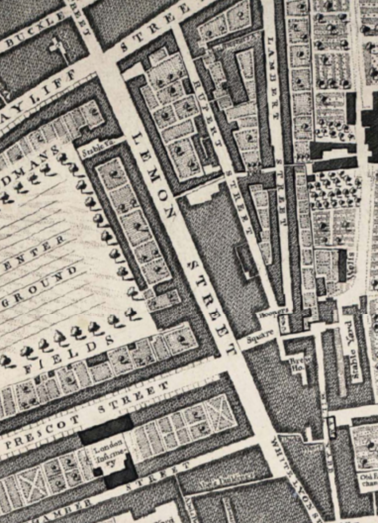
The distinctive names of Sephardic families of Portuguese and Spanish descent are easily spotted in the Land Tax lists for eighteenth-century Goodman’s Fields. These lists show that a number of families lived in or operated their businesses from large houses that lined Mansell Street, Alie Street, Leman Street and Prescot Street. A directory published in 1800 indicates that this activity continued into the nineteenth century, with merchants with the surnames of Bensusan, Pariente and Fonseca holding premises on Prescot Street and Leman Street. Iberian merchants often assumed aliases to protect themselves from the threat of kidnapping: one name might be used for business and another for family life, and sometimes a mixture of the two.
Sketches of three Spanish-Portuguese Jewish families based in Goodman's Fields:
Abraham (also known as John or Jose) da Costa Villa Real escaped Lisbon with his family of seventeen in 1726. In Portugal, he had held the position of Comptroller General of the King’s armies. When he learned of his imminent arrest for practising as a Jew, Abraham used a fire in the city as cover to leave for England with an extraordinary sum of money, said to exceed £300,000, on one of the ships in his control. After settling in London, Abraham leased a property on the south side of Prescot Street, a 'spacious and regular built' street.[1] One of ‘Chamber’s Rents’, his was one of about thirty terraced houses (now long demolished) inhabited by the upper and middle classes, particularly those connected to mercantilism. Abraham's sons married quickly and advantageously, cementing the position of the Villa Reals in London's Jewish society. One son, Jacob (or Gabriel de Villa Nova), a merchant, continued to live in the Goodman’s Fields area until his premature death in 1733. His house, possibly adjacent to his father’s on Prescot Street, was bequeathed to his widow and young son, Abraham, who, at the age of nineteen, was later described as ‘gent of Prescot Street’.[2]
Extract from John Rocque's 1746 map of London showing the quality and open-ness of the streets and gardens of Goodman's Fields.
Abraham the Elder died a few years after his son in 1737, his own wife having apparently pre-deceased him. His will addresses three different young women who lived with him in Prescot Street. Leonor (or Judith), his granddaughter, whose father was a merchant then living in Portugal, and Luiza, 'single young woman', were gifted luxurious furniture and linen from the house, along with marriage portions and annual incomes. Rather than receiving a gift, a mixed-race enslaved girl named Izabell, of whom Abraham noted ‘I brought from Lisbon’, was gifted. The girl was given to her master's grandson, Abraham of Prescot Street. Izabell’s enslaved mother, Maria, had served the Villa Reals in Lisbon, although apparently was not taken to London like her daughter.
The patriarch of our second Sephardic family of note was Abraham Dias Fernandes (also known as Fernando Dias Fernandes or Miguel Vianna), also a resident of Goodman's Field's. He was a contemporary of Abraham da Costa Villa Real, and named as an executor in his will. The Dias family lived in Whitechapel from at least the 1720s and Abraham’s son Isaac Dias Fernandes (also known as Isaac Viana or Antonio Lopes Dias) lived on the east side of Mansell Street until at least 1742. Born in the late seventeenth century, Abraham Dias Fernandes originated from the Toledo area of Spain but moved his business to Portugal to increase his prospects. Having lived in Lisbon for five years, he fled the city in 1706 with his two sons, Isaac and Diogo, after having been condemned to wear penitential dress on account of suspicion that he was a practising Jew. His wife was burnt alive for the same 'crime'. Travelling via Spain and possibly the Netherlands, Abraham and his sons arrived in England with nothing, their goods having been confiscated in their absence and a death sentence issued.[3] Despite these adversities, Abraham successfully established himself in the wool trade, especially shipping goods to Portugal for distribution to Brazil. The Dias Fernandes family continued to operate from various warehouses and houses in the Goodman’s Fields area until the end of the nineteenth century.
Lisbon before the 1755 earthquake, which destroyed much of the built fabric of the city. Etching by Matthaus Seutter from Georg Braun's 1598 engraving. Rossio Square and Estaus Palace highlighed in orange. This was the Inquisition's headquarters, and public executions were often performed here. This was likely the site of Mrs Abraham Dias Fernandes' death.
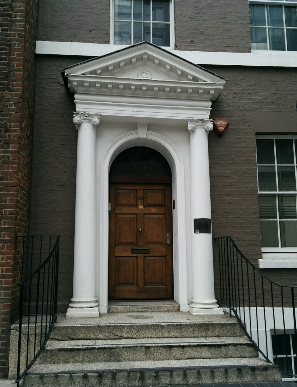
David Samuda was born in London in 1733 to a Portuguese refugee and physician, Abraham Samuda. Abraham had migrated from Lisbon to the Portsoken Ward of Aldgate sometime before 1723 and was almost certainly a kinsman of Isaac de Sequeira Samuda, the first Jewish Fellow of the Royal Society, who had also escaped from Lisbon to London in the first decades of the eighteenth century.[4] Not straying far from the area settled in by his father, David occupied 72 Leman Street (now the site of the police station) from the 1760s until his death in 1804. He was also associated with a property in Alie Street. His mother, or stepmother, Esther, leased a house on Leman Street from the 1760s to the 1790s, first on the east side and then on the west, likely living in her son's property for some of that time. David used Goodman's Fields as a base for his mercantile business. He owned several ships implicated in trade with Jamaica, and his son, also David (b. 1766), later followed in his father's footsteps. Samuda & Co. ships carried goods such as sugar, rum, logwood, fustic and mahogany from Jamaica to London, and the younger David became a partner in a Jamaican plantation which owned several hundred enslaved people. Proof of the strong Jamaican-London connection is found in the elder David Samuda’s will; money was bequeathed to the poor of Bevis Marks Synagogue as well as the Portuguese Synagogues in Kingston and Spanish Town, Jamaica.[5]
Doorway of No. 66 Leman Street, built 1760s and one of the last remaining fragments of the eighteenth-century development of the street. Extract of John Rocque's 1746 map of London.
These three brief sketches of Sephardic migration into Goodman's Fields suggest that there is much still to be discovered about how Whitechapel’s built environment was shaped by colonial trade in the eighteenth and nineteenth centuries, and perhaps especially in relation to East London’s sugar-refining businesses.
[1] Edward Hatton, A New View of London, 1708, p. 65
[2] TNA, C11/1608/17. Also see Wills of Abraham da Costa Villa Real (TNA, PROB 11/683/393) and Jacob da Costa Villa Real (TNA, PROB 11/659/372).
[3] Richard Barnett, 'Diplomatic Aspects of the Sephardic Influx from Portugal in the Early Eighteenth Century' in Transactions of the Jewish Historical Society of England, Vol 25, 1973, pp. 210-221
[4] Carla Costa Vieira, 'Observing the Skies of Lisbon: Isaac de Sequeira Samuda, an Estrangeirado in the Royal Society' in The Royal Society Journal, Vol 68, 2014, pp. 135-149
[5] Will of David Samuda (TNA, PROB 11/1412/83). Also see Eli Faber, Jews, Slaves and the Slave Trade: Setting the Record Straight, 2000, p. 311-12.
Last December it was announced that the Whitechapel Bell Foundry would close in May 2017, and this year has witnessed its closure and the end of what has been a remarkable story. Business cards claim the bell foundry as ‘Britain’s oldest manufacturing company’ and ‘the world’s most famous bell foundry’ – the first not readily contradicted, the second unverifiable but plausible. The business, principally the making of church bells, had operated continuously in Whitechapel since at least the 1570s. It had been on its present site with the existing house and office buildings since the mid 1740s. Derek Kendall's wintry photographs of the bell foundry in 2010 provide an insight into its historic buildings and the preservation of traditional craftsmanship until its closure. If you would like to read the Survey's full account, please click here to find the draft text.
On Christmas Eve 1872, a reporter from the London Evening Standard rambled through the streets of East London. His observations of the hurried preparations for Christmas commenced in Wapping and the area around Cable Street, then moved up through Commercial Road onto Whitechapel Road with its bustling market.
The newspaper report began with the reflection that: “the great duty and pleasure of Christmas is to buy the dinner for Christmas day.” It continued: “It is in the streets that the lower classes are to be found on Christmas Eve, and the region from Whitechapel Road to the river may be taken typical of the whole district…Upon Christmas Eve the majority of those who frequent the pawn-shops [of the Highway] do so to obtain money, but upon the Saturday pre-ceding, and indeed during the week before Christmas, up to the very evening before, the movement has been the other way. Articles of clothing, little pieces of furniture, and ornaments have been redeemed with a view of making house and person look their best upon the festival. But we must not linger here, for the Whitechapel Road is our goal: here we shall see the real Christmas Eve work at its height. We cross the Commercial Road broad, well-lighted, and with good shops of all kinds…On now through more narrow lanes, and then out into the Whitechapel Road. Here is indeed a contrast to anything we have seen before, a scene of bustle and noise, of amusement and business, of general good temper, such as it does one good to see.”
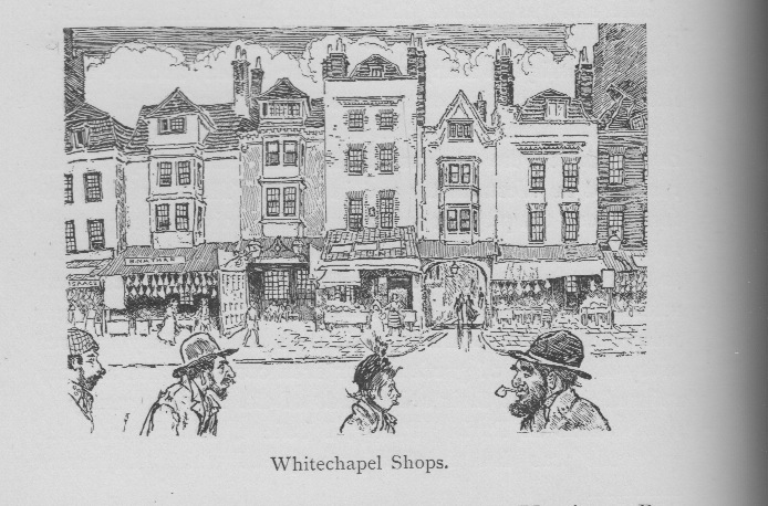
'Whitechapel Shops' by Joseph Pennell, c.1899. It actually depicts Aldgate High Street. Illustration from Walter Besant's 'East London' (London: 1901), p.190.
Aware of its wide readership, the report outlined that: “Whitechapel Road is well known in the East; it is its Regent Street and Oxford Street rolled into one…Still, well known as the road is in its own quarter of the town, there are existent Englishmen who have not seen it, and for their information I may describe it as a road of great length and considerably wider from house to house than any thoroughfare I know of in London. Upon the south side the pavement is wide, and towards the western end occupied by costermongers’ trucks and stands, but at the eastern end it affords in its desertion and darkness a singular contrast to the bustle and activity of the north side of the road. Here the footway is perhaps fifty feet wide, and along its whole length, with their backs to the road, are an unbroken line of stalls, carts, trucks, and erections of itinerant vendors. The walk between this row of stalls and the shops was so crowded with people that it was difficult to make one’s way, impossible to walk fast. It resembled a French scene more than an English one, and might, with a little stretch of the imagination, have been taken for a Parisian Boulevard during the fair at the end of the year."
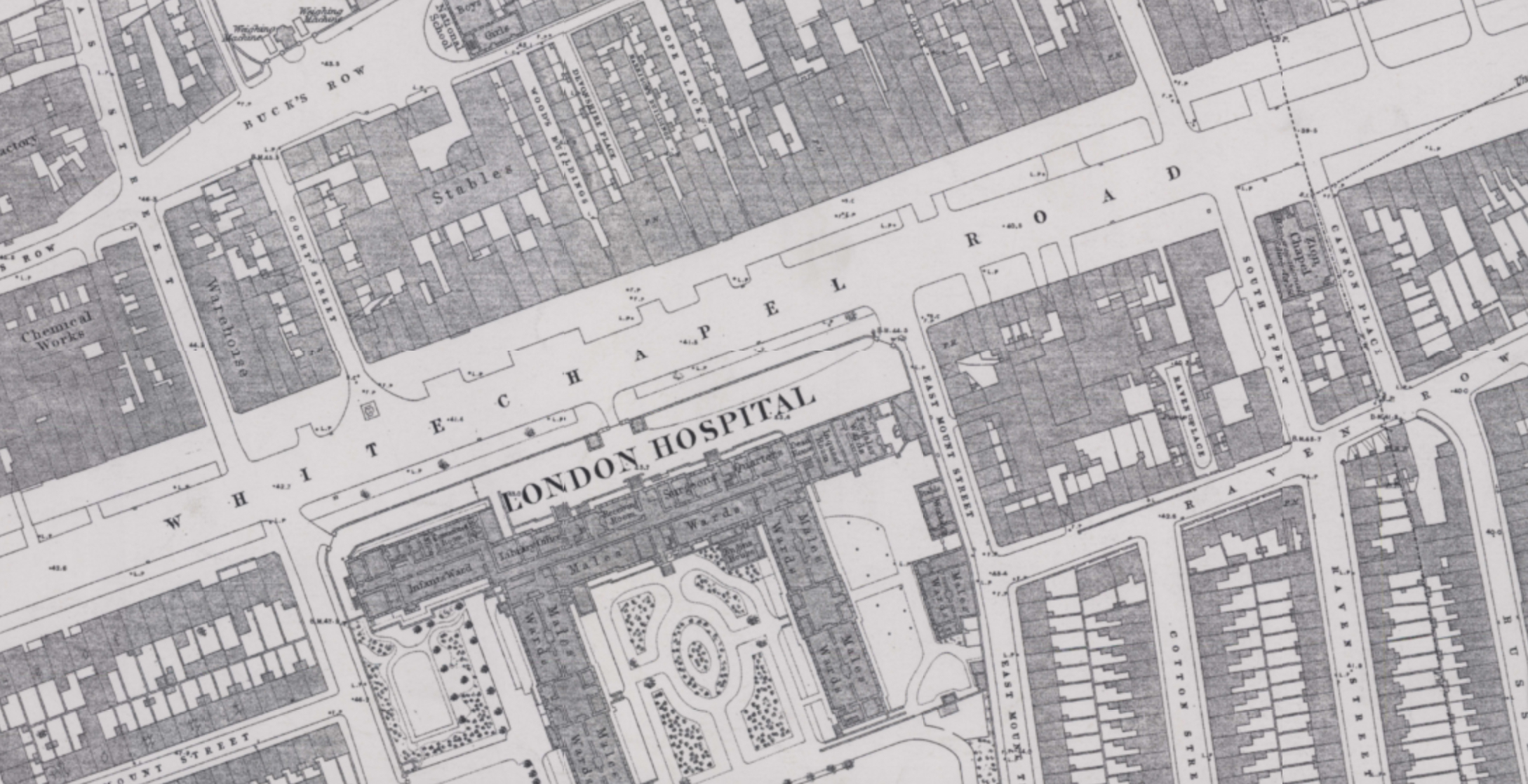
Extract from Ordnance Survey map of 1873.
"Here was the great market of the East End, here was shopping going on in full force. The variety of the contents of these stalls was wonderful. Here was a bower of evergreens, holly, and mistletoe; next to it a truck with oranges, then fish, then piles of vegetables, cabbages, parsnips and turnips. Then came stalls of toys, drums and whistles, of dolls, paper lanterns, and gilt gingerbread, stalls of toys at four a penny, choose where you will; men selling twelve articles, among which was a gold wedding ring, for a penny; men with yards of songs; stalls with looking glasses, stalls belonging to butchers and furniture shops on the other side of the path, which had spread across and formed an island dependent on the parent establishment; tin-ware stalls, second-hand boot stalls, stalls where you shoot for nuts, and stalls where you could turn a wheel for toys….Here were booths with hardware, with baskets and with brushes, and covered stalls with bonnet and cap flowers, with ribbons and neckties, and brightly coloured paper flowers for mantel pieces and vases. Here were men with trucks of rusty locks and keys, jacks for roasting at a penny, and toasting forks and scones for six candles at the same price."
"Here, too, were creature comforts for present use, baked potatoes, hot pies, and shell fish cooked and raw. Prominent among them was an erection belonging to a vender of bloaters, but he had so completely lined it with fish, hanging in regular lines tail downwards, that it sparkled in the light until it looked like a scene from the icicle palace of King Frost in a Christmas pantomime. Imagine all these stalls, multiply them by fifty, mix them up together confusedly illuminate them by petroleum gaslights, surround them with a busy, amused, anxious throng, some purchasers, some lookers-on, put children’s faces peering everywhere, and add the shouting of countless costermongers, and the picture is complete…"
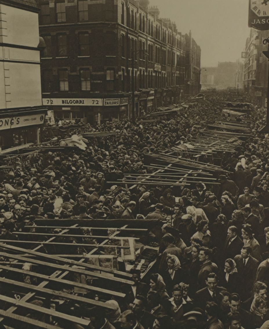
Petticoat Lane, Christmas shoppers. Image from the Illustrated London News, Dec 1949.
"The drizzling rain thinned the crowd a little early in the evening, but at about nine o’clock it held up, and the pavement was soon crowded again. There are many men here, but the women are in the ascendancy, and feel upon their own ground, as may be judged by the following remarks, which I heard, with variation countless times, “Where is your father, Eliza? What a man that is! I hav’n’t bin five minutes in the shop, and there he’s gone again, just staring about, you know…We hav’n’t settled yet which piece of beef we’re going to have for tomorrow….”
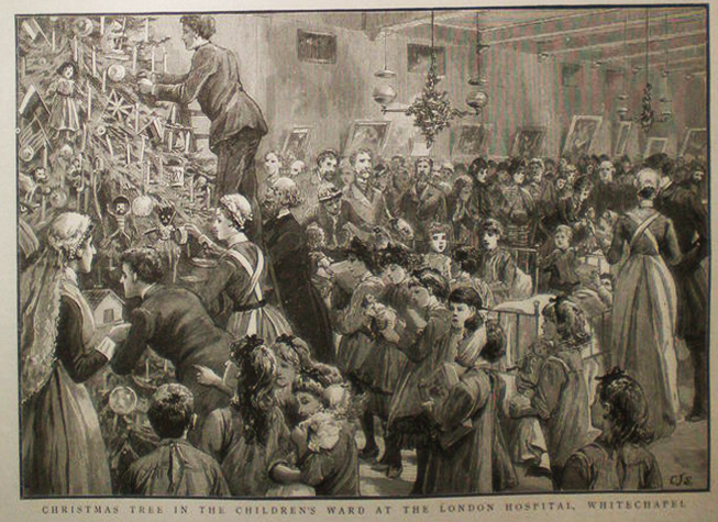
The Children's Ward of the London Hospital at Christmas. Image from The Graphic, 30 Jan 1886.
"It is not every one, however, who can afford to buy joints of meat. Here and there among the busy merry crowd hang thin women in worn clothes…They are the shadows upon the scene…Some of the children’s faces too, must be looked upon as shadows, pale, worn, and preternaturally old, looking with eager eyes at the toys, the bright dolls, and shining knickknacks…Most of us like to see snow upon the ground on Christmas day, but it is a pleasure well worth giving up when we consider that what is pleasure to us is exquisite pain to thousands of these famished and ill-clad little ones.” [1]
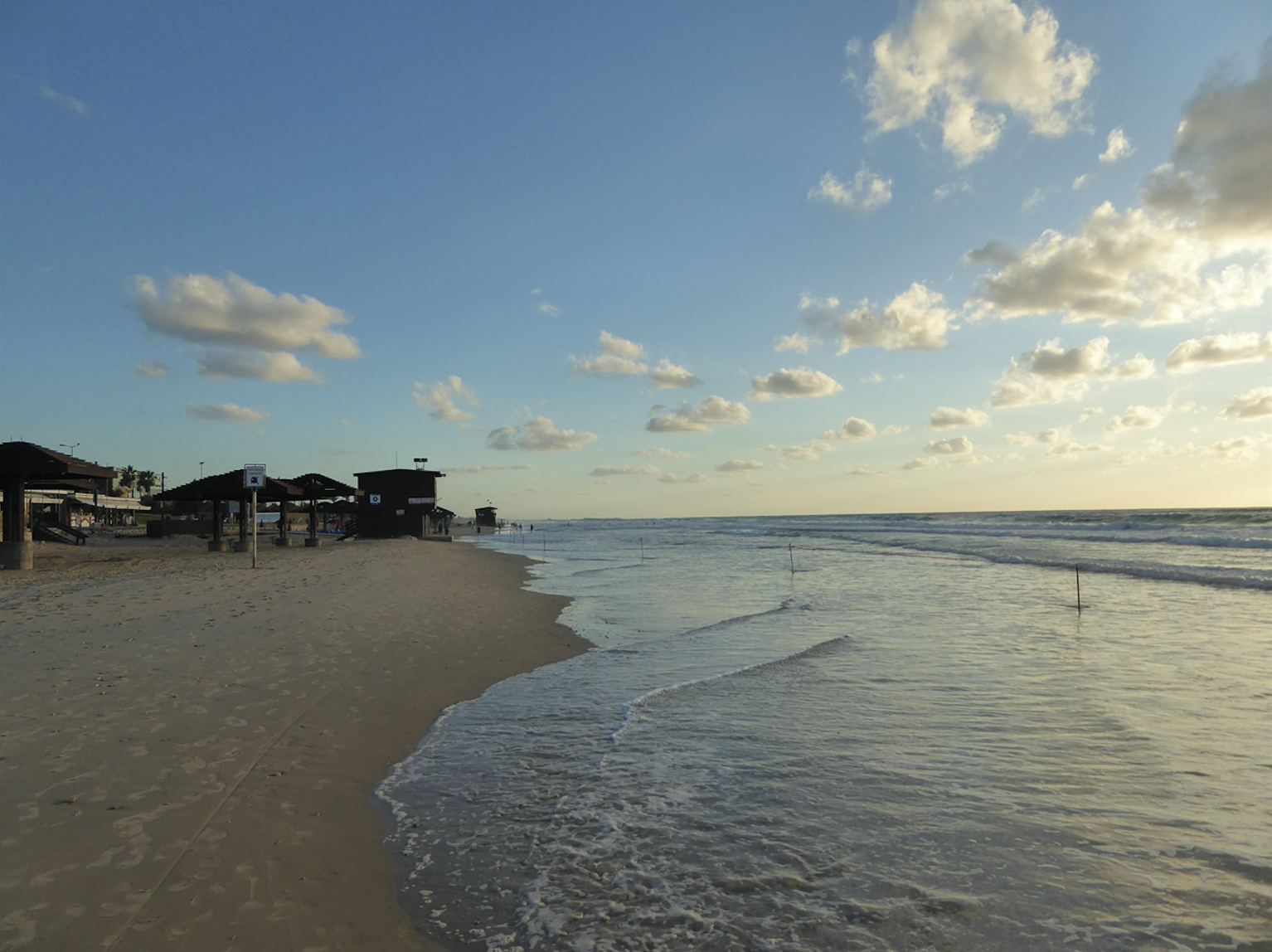
Oral histories are a core part of our work on the Whitechapel project. Our interviewees have come from all walks of life and from the many communities that make up Whitechapel past and present. They have also ranged widely in age, from 30-something to 99. But what all the interviewees had in common, until recently, was that they all, even if no longer in Whitechapel, still live in or near London. Many old Whitechapel-ites, however, have roamed rather further than Newbury Park or Edgware, and last month one of the Survey historians met four who now live 2,000 miles away, in Israel.
A world away from 1980s Whitechapel...the beach at Haifa where the interview with Jack and Gwen White was conducted.
David Shaffer (b. 1947) left Whitechapel when he married at 21 but then spent nearly 40 years in the US before 'making Aliyah' to Jerusalem in 2005. Gloria Spielman (b. 1963) has lived near Tel Aviv since 1988, though her mother Sophie still lives in Vallance Road and has been in the news recently, fighting to save her home there. Jack White (b. 1925) and Gwen White (b 1930) also moved, to Karmiel in northern Israel, in the 1980s. Interesting lives, a world away from the East End, but these interviews, conducted in balmy November weather in Jerusalem, Tel Aviv and Haifa, were all about Whitechapel. Or were they?
The project's map follows the 'official' borders of Whitechapel, as defined by the old parish of St Mary Matfelon, or the London borough as it was up to 1900. But Whitechapel as understood by those who grew up there is a much more elastic entity. Strictly speaking, none of the interviews grew up in 'Whitechapel'. David Shaffer grew up around Thrawl Street, off Brick Lane, what is technically Spitalfields, to the north of Whitechapel. Jack White lived in Jubilee Street, just to the east of Whitechapel, in Stepney. But they both thought of it as Whitechapel. By contrast Gwen White did not think of where she lived, in Wellclose Square, to the south, as Whitechapel, at all. Yet the west side, where she recalled the faded grandeur of 18th-century houses (once the Danish embassy) and the tiny cottages of Harad's Place (now just a railed pathway next to Shapla Primary School), is 'official' Whitechapel. One thing that is certainly emerging from our interviews and contributions to the Whitechapel map is that identification of 'place' is just as mutable and variable as any other kind of identity - cultural, religious, racial or national.
Last week, two events in Whitechapel drew attention to recent initiatives seeking to archive Somali and Muslim history in London's East End. Although independent of each other and with differing approaches to the archival process, projects by Numbi Arts and the East London Mosque are ensuring African and Asian inflected histories of Whitechapel are brought to light and documented. The Survey was invited to participate in both events as a supporter and a brief report follows.
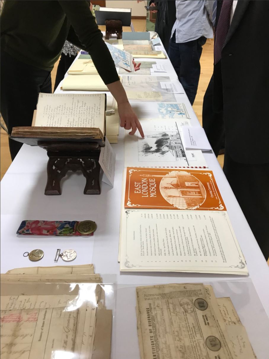
On 22nd November 2017 the East London Mosque Archives' strongroom was inaugurated. The new strongroom provides a stable and securely managed environment for records ranging from the London Mosque Fund Minute Book (from 1911) to photographs of the mosque's pre-fab building on Fieldgate Street in the 1970s. The opening itself was symbolically important, celebrating the first such Muslim archive in the UK. The evening was led by Sufia Alam of the Maryam Centre who has told some of her own Whitechapel story on the Survey's website here and here. Many trustees were in attendance, some of whom have served the mosque for decades and can remember the former building on Commercial Road. Summaries of the lives of Sulaiman Jetha, Haji Taslim and Hajja Mariam Ali (née Josephine Mary Morgan) can be read here.
Photo credit: @ELMarchives
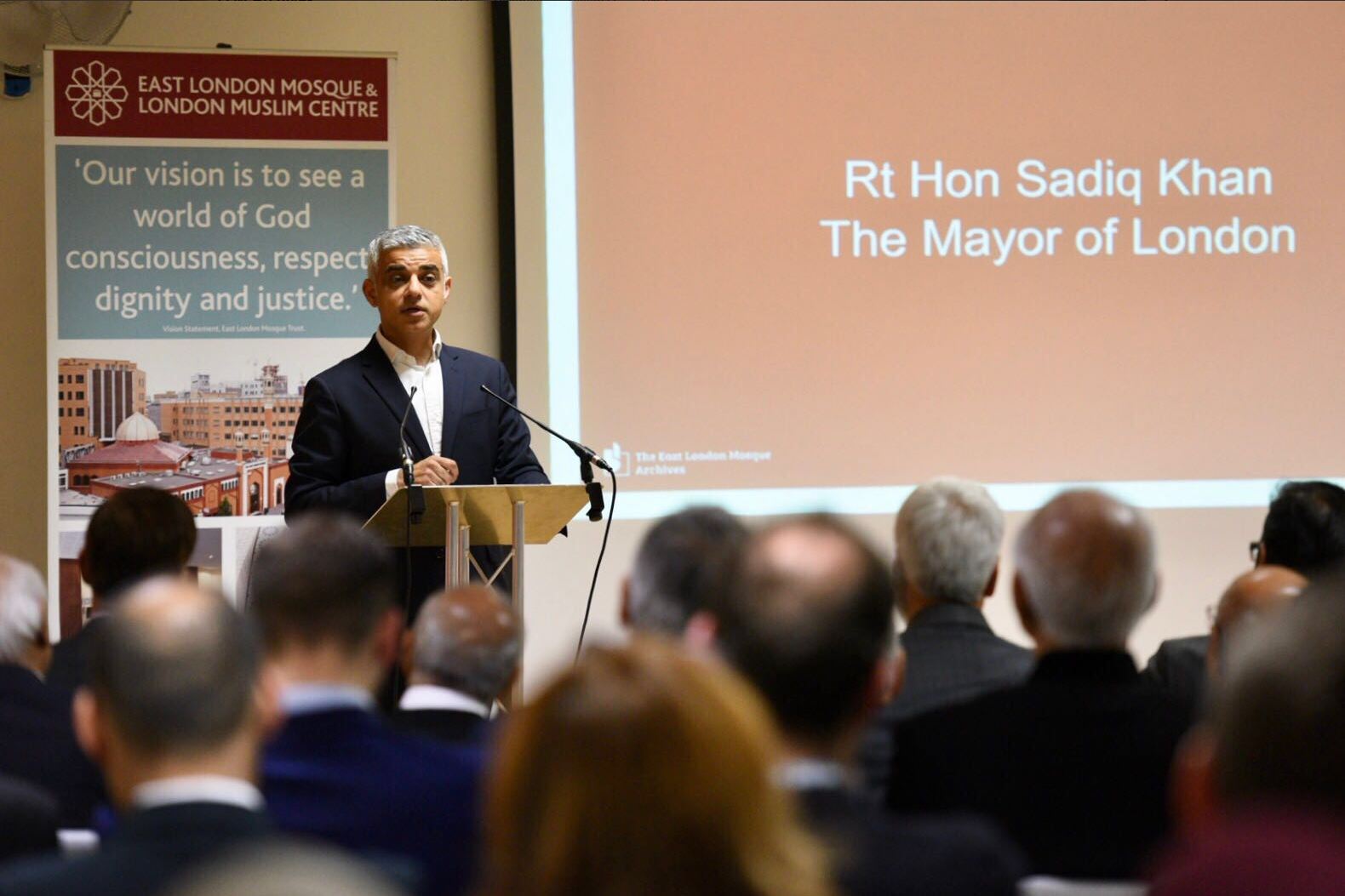
Londoner and British Muslim, Mayor Sadiq Khan formally opened the strongroom with a speech that included the commendation that, "familiarity with our history helps us understand our present...only by chronicling our history can we benefit from the knowledge and wisdom of those that have gone before us." His visit was marked by a commemorative plaque which will be installed outside the strongroom. Other presentations were made by Mayor John Biggs of Tower Hamlets, Dr Valerie Johnson of The National Archives, and Rushanara Ali, MP for Bethal Green and Bow. Shahed Saleem, Senior Research Fellow at the Survey of London Whitechapel, was honoured with an award for his contribution to the ELM Archives project.
Photo credit: @MayorofLondon
The following day, at London Metropolitan Archives, Abira Hussein led a workshop which focussed on what an archive does and explored ideas of collective memory. She also presented documents relating to the lives of Somali seamen living in East London. The theme was expanded on by Paul Dudman of the Refugee Council Archive (UEL), who considered the issue of forced displacement in the context of the Somalian civil war. With a strong tradition of oral history, British-Somalian heritage is not always easily located in archives and Dudman noted that where "memories of refugees are 'moving', digitalised oral history archives can be seen as 'a project of human rights'".
Afterwards, participants gathered in Spitalfields to begin a ‘Hido Raac’ (walk) south through Whitechapel. This was led by Hudda Khaireh and Kinsi Abdulleh of Numbi Arts, however everyone in attedance was invited to share their knowledge, which led to some unusual connections. As the group walked by the former Jewish Soup Kitchen at Brune Street, we learned that Somali soup kitchens once proliferated in the East End, at Calcutta House we stopped to consider the flow of trade between Africa, Asia and the UK during the colonial nineteenth-century, and at St Botolph's Aldgate we heard recent stories of tragic loss in the Somalian community, some of whom had drawn on the charitable services provided at the church.
The day was covered by journalist Hana Bihi for London Live. You can view her audio-visual report featuring Abira and Kinsi here.
The Survey of London would like to share a self-guided walk around the eastern portion of the Royal London Hospital’s estate, bounded roughly by Whitechapel Road north, Cavell Street east, Commercial Road south, and New Road west. Download our route map and guide for a fuller introduction to the history of the hospital and its estate: Guide to a walking tour of the Royal London Hospital Estate
Date and Time: Friday 14th July, 2017 - Friday 14th July, 2017
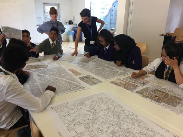
In July 2017 we collaborated with the Whitechapel Gallery and artist Sara Heywood in a workshop with the London Enterprise Academy, a local school situated on Commercial Road.
Around 15 students from years 7 to 9 took part, and engaged in activities where they could think about and describe their experiences and memories of Whitechapel.
They drew views of Whitechapel on the windows of the gallery learning space, and identified objects in the local area. Students also created overlay drawings of current and historical maps of the area, so they could see how the fabric and use of buildings and streets has changed over time.
The students described their school building, what they like about it and how they use it. The building was built in the 1980s, named Aneurin Bevan House and used by the NHS. That building had replaced the King's Hall which was built as a Temperance Hall then converted to Cinema in the early twentieth century.
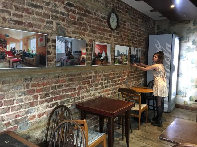
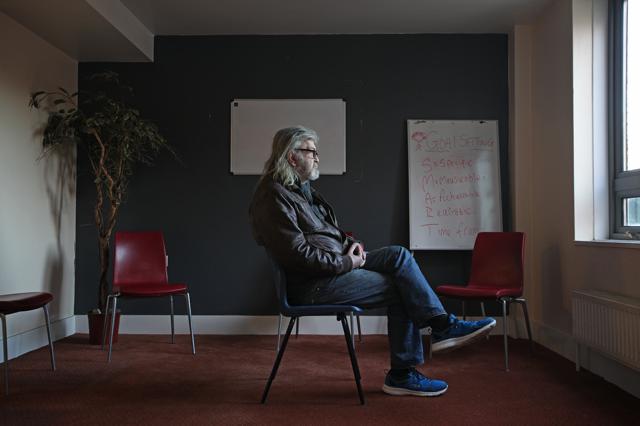
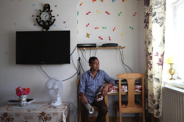
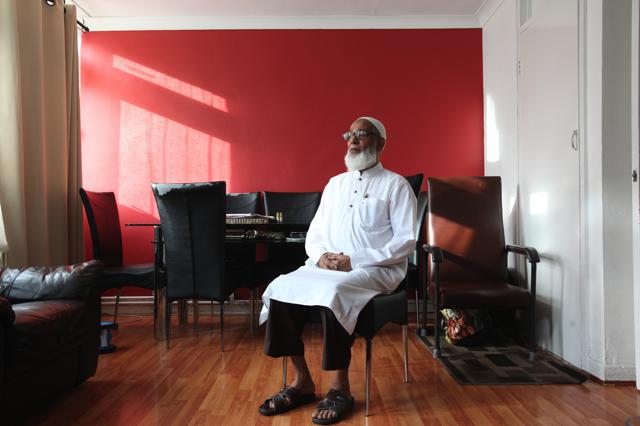
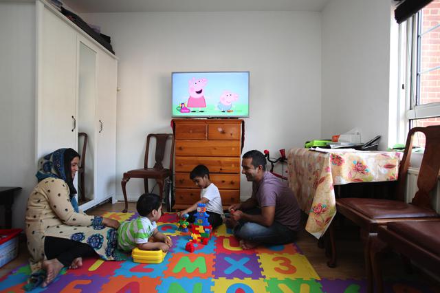
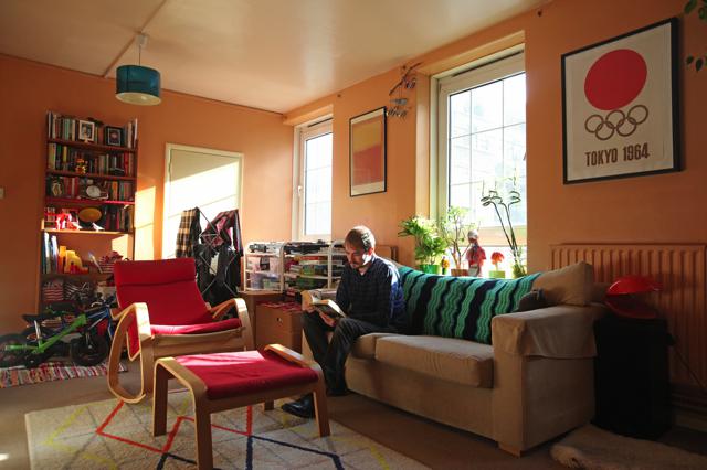
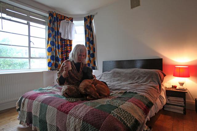
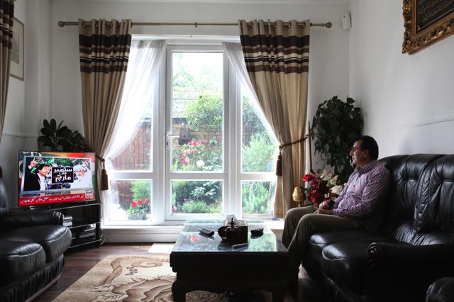
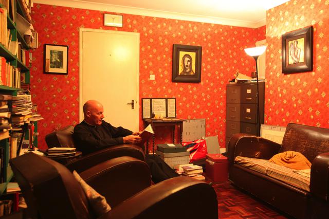
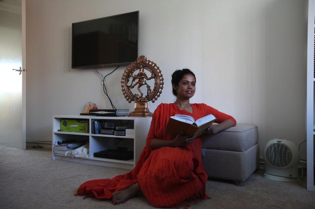
During the summer of 2016 Rehan Jamil was commissioned by the Survey of London to produce a set of photographic portraits of people at home in Whitechapel. The resulting portraits feature people from a variety of backgrounds in their private spaces and were exhibited at the Aldgate Coffee House, 68 Whitechapel High Street, E1 7PL from June to September 2017.
Rehan found people for the project via friends, family and work colleagues mostly using Whatsapp and occasionally asking people in the street. Rehan would like to thank all those who have participated in the project for allowing him into their homes and sharing their personal spaces. Rehan lives in the East End of London and describes himself as a documentary photographer who is primarily concerned with communities in transition.
Anjali Chakrabarty, Whitechapel Road - 'I love living here, I use to work in a school close by. I went on a Silver Surfer course and now I use the computer to talk to my mother in Bangladesh'
Keith Harrington, Booth House, Whitechapel Road - 'We have a roof garden, it's nice up there'
Farid Khan, Cephas Street - 'The school and hospital are close by. There are local people I know and traditional shops for special ingredients here.'
Tobaris Ali, Cannon Street Road - 'I arrived in 1965 and became a volunteer at the mosque in 1976. It is a good area, good for education - I have grandchildren now and education is important.'
The Rahman family, Vallance Road - 'It is very nice to live within the community, everything is literally in walking distance but also very expensive and overcrowded.'
Alex Rhys-Taylor, Brune Street - 'It is a priviledge to live in Whitechapel, a part of London where local history and everyday life hold answers to some of the most pressing issues of our age.'
Tigs, Myrdle Court - ' I have lived in Myrdle Court for nine years and it's a special place. There is a sense of community in the building that is rare in London.'
Umer Farooq, Cable Street - 'It is a ground floor flat, so I have a garden which is really nice.'
Alan Green, Victoria Park Sq - 'I have lived here for almost twenty years now. My Dad grew up in the area before the Second World War, so it has been rather like coming home although it has changed a lot since then. I love the diversity and the real sense of pride in our history of welcoming and supporting immigrants from across the world.'
Suparna Roy Barman, Mansell Street - 'I feel at home in Whitechapel, I feel I have everything here so I can stay at home and experience everything. The city is on my door step and it is a creative area - art and culture are important to me.'
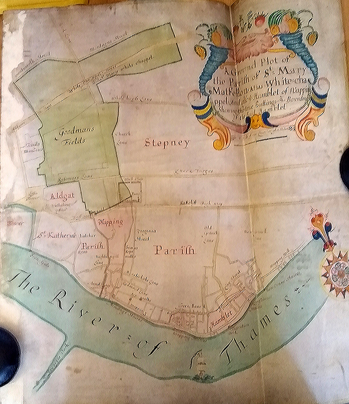
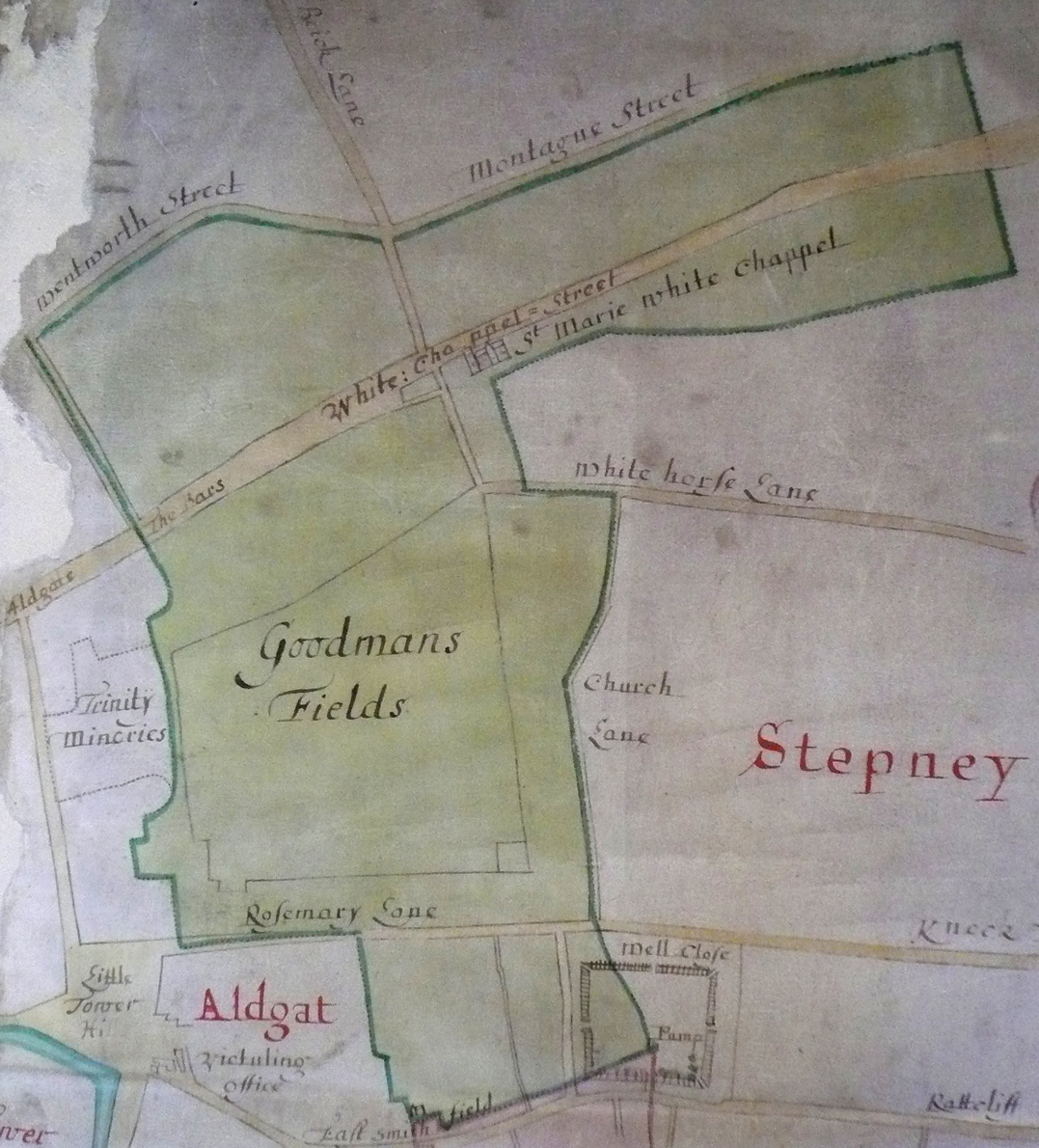
In 1708 Brasenose College, Oxford, purchased the advowson or patronage of the parish of St Mary Matfelon, Whitechapel, from the parish of Stepney. This was confirmed by Act of Parliament in 1710 and gave the College the right to appoint Whitechapel’s rector when vacancies arose. This was controversial, unwelcome to many in Whitechapel. The right was given up in 1864. As a result of this link there is a map of the parish of Whitechapel at Brasenose College Archives (reference B 14.1/44). It is a beautiful thing, painted and drawn on vellum and in an excellent state of preservation, its colours still vivid.
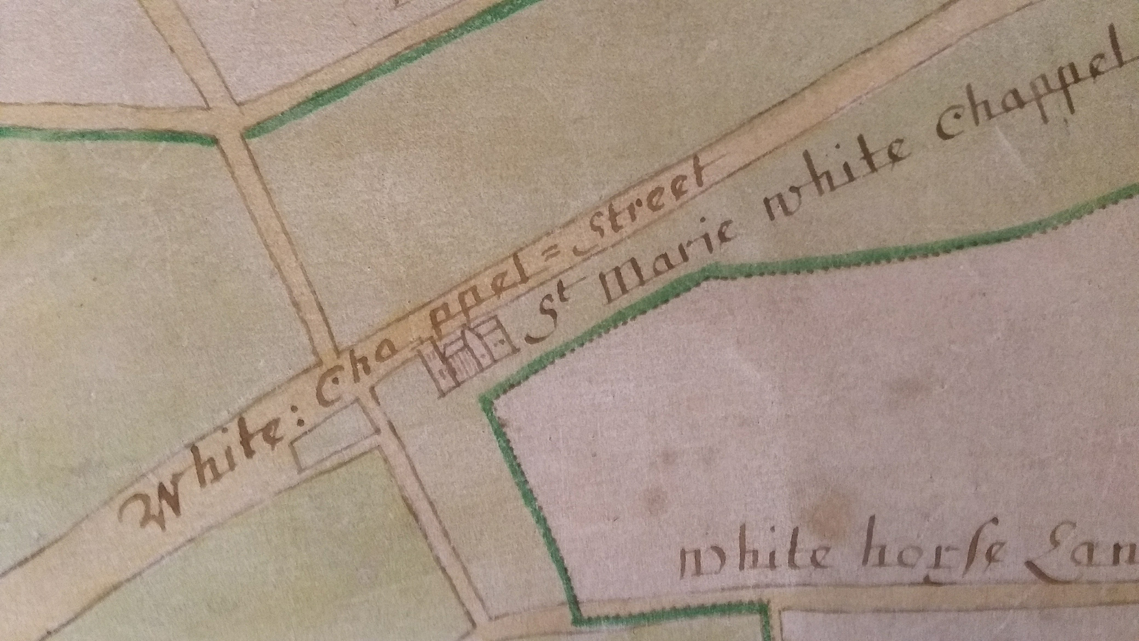
It shows the parish shaded green and extending from Wentworth Street and Montague Street in the north across Whitechapel Street, Goodmans Fields and Rosemary Lane to Well Close, which is depicted as enclosed by what were probably timber palings with a pump in its south-east corner.
There is greater detail to the south as far as ‘The River of Thames’ in the L-shaped area that was known as Wapping-Whitechapel. This separated from Whitechapel in 1694 to become the parish of St John Wapping.
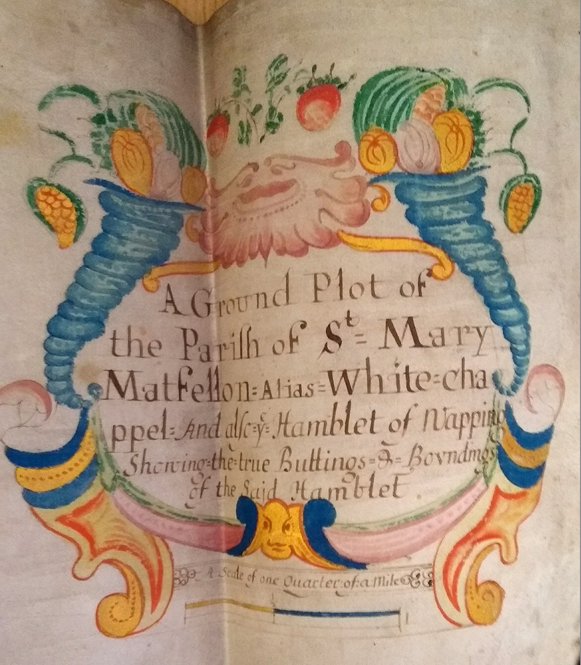
A splendid cartouche (top right), bracketed by cornucopias, titles the map as ‘A Ground Plot of the Parifh of St Mary Matfellon: Alias White-chappel And also ye Hamblet of Wapping Showing the true Buttings & Boundings of the Said Hamblet’.
This focus of attention suggests that the map might have been prepared with the separation in prospect. It can be no earlier than 1673 as the parish church of ‘St Marie White Chappel’ is depicted with a transept, a feature it lacked before the rebuilding completed in that year that gave it a cruciform or cross-axial plan.
The Survey of London and Brasenose College Archives would welcome any observations about the more precise dating of this map.
With thanks to The Principal and Fellows of Brasenose College